
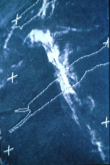
Jetstream Cirrus Clouds
|
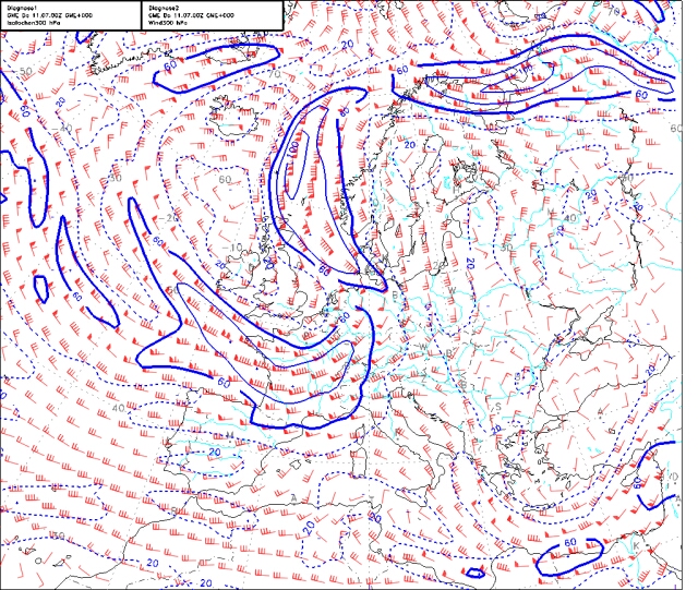
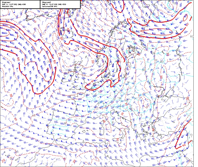
The series of images shows cloud types which can
occur if a Jet stream is located above the observer. Map1.jpg
and Map2.jpg which include isotaches show an S-shaped Jet stream
above Germany at a pressure level of 300 hPa from Thursday 7/11/02
to Friday 7/12/02. Its maximum velocity was around 60 m/s and
it passed the observer from Thursday noon to Friday noon in northerly
direction. |
|
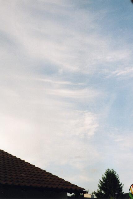
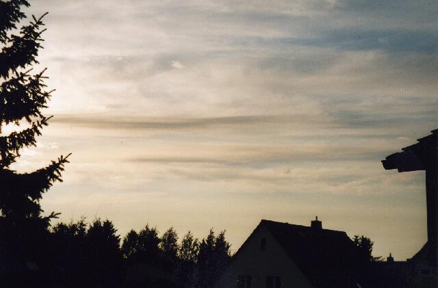
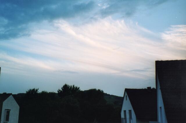
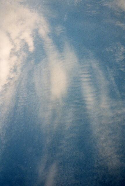
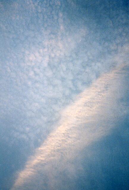
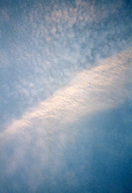
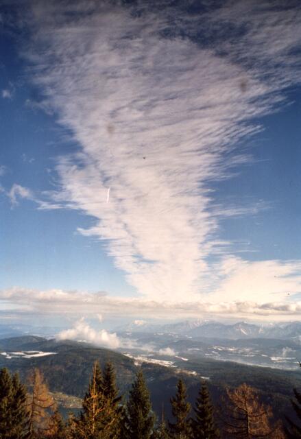
The following images were taken Thursday night at around 8 p.m.. Drawn-out Cirrus clouds indicating high air velocities are pictured. |

|
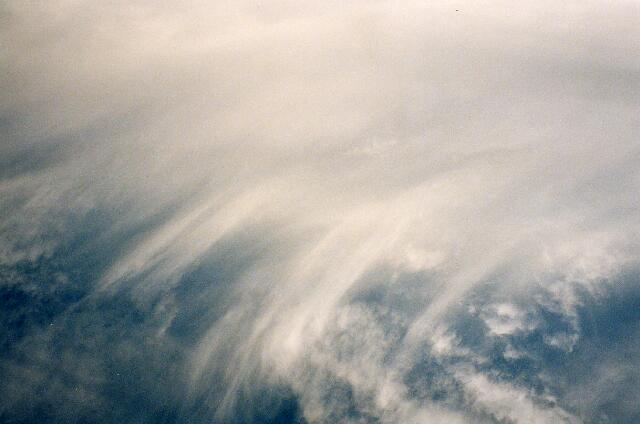
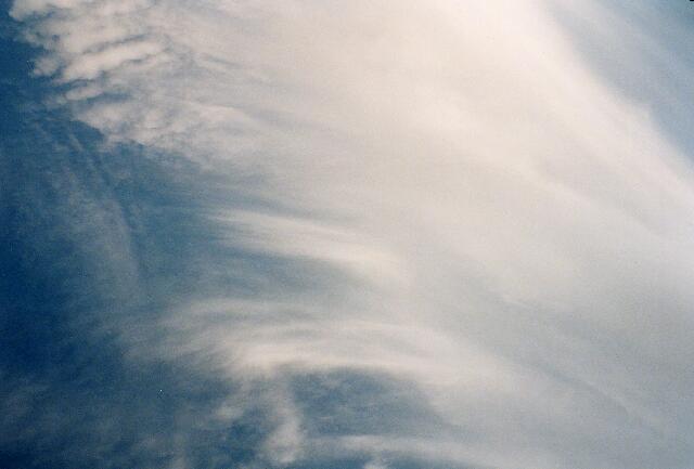
... taken at the same time display a closer look at the Jet stream Cirrus clouds. Single fibres can be recognized here. They are generated when larger ice-crystals sediment below the main bodies of the Cirrus clouds. The wind velocity is smaller there and the larger, sedimented particles remain behind the higher, smaller and faster moving cloud particles. |
|
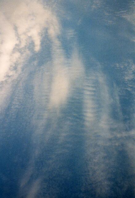
Sometimes wave structures could be noticed in the Cirrus clouds. Such waves arise, if two air flows with different velocities pass each other. For sure this is the case for Jet streams and their borders. The shearing at the interface of the flows generates turbulences which then can lead to waves in the clouds. |
|
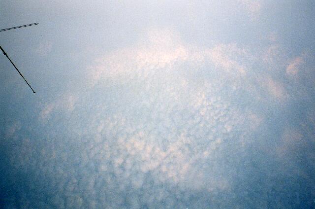
After the main part of the Jet stream has moved towards northerly directions at late Thursday night, a calm sky remained, covered with Cirrocumulus clouds as shown in the next images. |
|
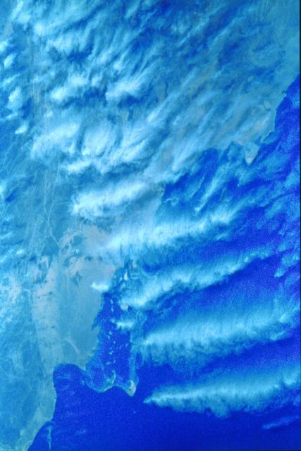
Additional kinds of Jet stream clouds are presented by the following pictures taken from the Space Shuttle: |


|
JS_NASA1.jpg: "Meteosat view of Red Sea Region: A westerly jet stream produces a narrow, contained band of cirrus clouds that stretches across the Red Sea from the Sudan to Saudi Arabia. This Meteosat 2 thermal image is the sort of weather "picture" we are familiar with from television weather forecasting. Meteosat 2 is located in geosynchronous orbit that is, it stays overhead the same point on the Earth's surface at an altitude of 22300 miles. This image was taken during STS 41-C on April 5, 1984, and makes an interesting comparison with the shuttle astronaut's view of the same cloud system from about 200 miles above Earth ..." JS_NASA2.jpg: "This photograph taken from 200 miles above the Earth shows the same jet stream cirrus depicted in JetStreamCirrus1.jpg. The contained uniformity of the cloud formation reflects the narrow track of the jet stream moving from left to right across the frame. The lower altitude of the shuttle photograph shows that the cloud band illustrated by the Meteosat thermal image in fact comprises a series of distinct and precisely spaced roll clouds. These are created by a rolling motion in the upper level air current." JS_NASA3.jpg: "The series of cirrus clouds is known as "roll clouds" because they are sculpted into tight rolls by air currents from the jet stream over Saudi Arabia and the Red Sea. The crest-to-crest spacing of the cloud bands can be used to calculate the velocity of the jet stream. This is a close, almost vertical shot of the cloud band in JetStreamCirrus2.jpg." JS_NASA4.jpg: "This oblique photograph taken over Namibia reveals another effect of jet streams. Here two streams converge; cloud has formed in the corridor between the two streams. Turbulence along the margins of the jet stream may explain the sharp boundary (STS-41D, August-September 1984)." JS_NASA5.jpg: "This is a closer and more detailed view of
the same jet stream feature taken by the STS 41-D crew. The point
of convergence of the two air streams is precisely located by this
photograph. |
|
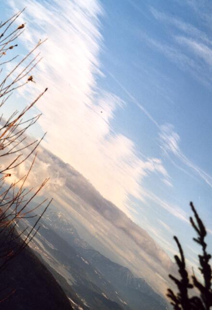
Bands of Jet stream Cirrus clouds observed from the ground are pictured in the last two images. They are similar to the space views of JS_NASA2.jpg and JS_NASA4.jpg. In order to image a maximum range of free sky between the trees the images were made at a slope. |
|
Map1.jpg and Map2.jpg: German Meteorological Service, Diagnosis Map (Map system), July 2002 JSCirrus1-4.jpg; JSDetail1+2.jpg; WaveInCirr1+2.jpg CirroCumulus1-3.jpg: S. Borrmann, Ingelheim, Germany, 11 July 2002 JS_NASA1-5.jpg from: Pat Jones, "Shuttle views the Earth: Clouds from Space", Planetary Image Centre / Lunar and Planetary Institute, NASA, 1989. (October 2002) JSCirrus7+8.jpg: S. Borrmann, Pulpit Rock, Carinthia, Austria, December 2001 |
![]()