
Windshear: Cumulus mediocris and congestus Clouds

|
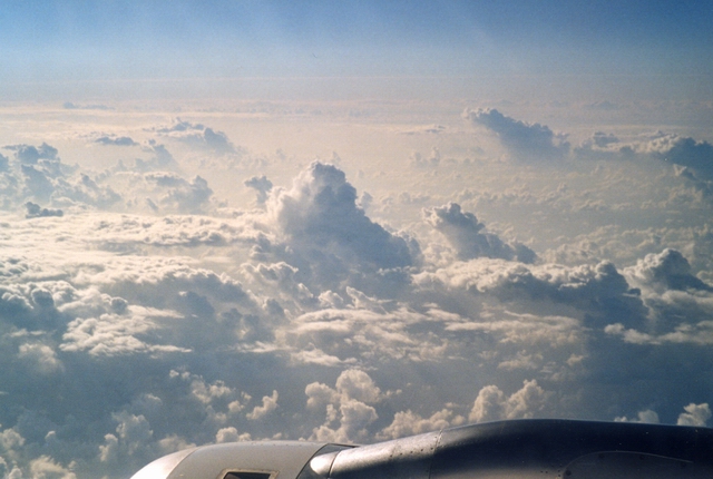
Shearing1.jpg: The clouds in the centre and the background are
in the process of growth to the Cumulus congestus state. Hence there
is a shear flow from right to left (i.e. from north to south) above
the major cloud cover which "tips" the high-growing towers.
Here the wind interrupts the development to fully-grown Cumulonimbus
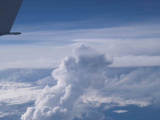
clouds. Shearing2.jpg: A single Cumulus congestus tower is shown which is tipped to the right by the wind shear. Looking closely at it the observer recognizes a pileus above the cloud top. |
The cruising altitude was 11300 m and the cloud top is not much below the aircraft. In the background a Cumulonimbus system can be seen which is also influenced by the wind shear. Shearing3.jpg presents a whole field of swelling Cumulus congestus
tipped to the right side. |
Shearing1.jpg: S. Borrmann, flight from Stockholm to Frankfurt,
22 June 2002 from 1 p.m. to 3 p.m. Shearing2.jpg, Shearing3.jpg: S. Borrmann, flight from Fortaleza
to Sao Paulo, Brazil, 2 February 2004, 4:49 p.m. and 5:01 p.m. |
![]()