
Cloudstreets


.jpg)
.jpg)
.jpg)
.jpg)
.jpg)
.jpg)
|
Streets1.jpg to Streets5.jpg: This generates weak helical circulations of the air parcels that move around the cylinder in a spiral path from the top to the bottom. The tangential velocities of the flow along the curved surfaces are in the range of 1 m/s and are hard to measure directly. Two vicinal rolls rotate like two gearwheels grabbing into each other in opposite directions, i.e. one clockwise and the other one counter-clockwise. The diameter of the rolls is similar to the altitude of the marine boundary layer. By this means convectively ascending air bubbles ("plumes" or "thermals") which would be lifted vertically without horizontal winds are arranged in parallel rows within the boundary layer. Strong anabatic winds occur at the interface between two surfaces of adjacent rotors where the velocity vectors point upwards. In the case of sufficiently high humidity - what is often the case above the warm ocean - and a lifting condensation level within the boundary layer, cloud bands are formed below the upper limit of the marine boundary layer between two vicinal rotors. The vertical extension of the clouds is thereby determined by the altitude of the condensation level and the temperature inversion at the top of the boundary layer. So the clouds of the street have mostly similar sizes. |
These kinds of cloud streets are also formed as a result of advection
of cold air over warm water surfaces. This is demonstrated in chapter
Isobaric Mix Clouds.
Above the oceans these cloud streets are often slowly converted
into cellular arrangements. Original Caption Released with Image: These MISR images were captured on June 6, 2001, during Terra orbit
7808. The entire vortex street can be seen in the top panel, which
is a natural-color view from the instrument's nadir (downward-looking)
camera. The area covered measures 365 kilometers x 158 kilometers,
and a cloud-clearing effect is apparent at the vortex centers until
finally closing on the sixteenth "hole". The bottom panel
is a stereo anaglyph of a portion of the vortex street, compiled
using data from MISR's 26-degree forward and 70-degree backward
viewing cameras. This view covers an area of about 183 kilometers
x 96 kilometers. Despite the vertical exaggeration afforded by using
widely separated angles, the relatively modest height variation
in the cloud layer implies a vertically stable atmosphere. To facilitate
stereo viewing, the images have been oriented with north at the
left. Red/blue glasses should be used with the red filter placed
over your left eye.Information on ordering glasses can be found
here. |
Fluid dynamicist Theodore von Karman was the first to derive the
conditions under which these turbulence patterns occur. Von Karman
was a professor of aeronautics at the California Institute of Technology
and one of the principal founders of NASA's Jet Propulsion Laboratory.
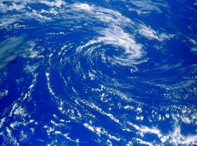
Anticyclone.jpg: This image which was taken from the Space Shuttle shows that clouds can be arranged in large-scale, spiral patterns. Original Caption Released with Image: Streets1.jpg to Streets4.jpg: S. Borrmann, flight from Frankfurt
to Lanzarote, 27 September 2003, around 6:30 a.m. Spin1-5.jpg: S. Borrmann, flight from Tel Aviv, Israel, to Frankfurt,
3:30 p.m. MESZ, 2 June 2005
|
![]()