|
|
|
Specials |
|
| Isobaric Mix Clouds | |
| Mix Clouds II | |
| Cold Front | |
| Convective Action | |
| Overview | |

Isobaric Mix Clouds
 Arctic_Smoke1.jpg |
 Arctic_Smoke2.jpg |
 Scheme.jpg |
|
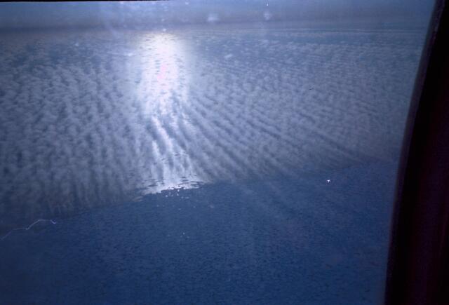
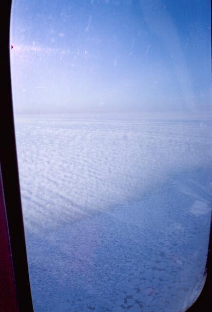
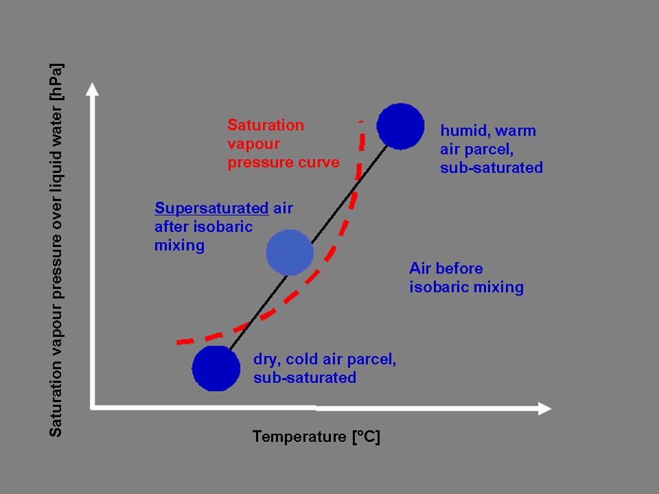
During the CEAREX field campaign with the Norwegian ice-breaker "Ploarbjörn" helicopter flights over the eastern Greenland ice-edge were performed. Both images show examples for cloud formation caused by isobaric mixing, the so-called "arctic smoking". Cold sub-saturated air flows from the ice over the ocean that is comparatively warm with -1 deg C. Thereby warm, humid air from the ocean is mixed with cold, dry artic air. This mixture can be super-saturated and the small clouds shown in the images are formed. The same happens with the exhalation in cold winter weather. When someone exhales air from the warm, humid lung into the cold, dry surrounding air a small cloud is formed in front of the mouth as a consequence of the mixing. Mechanism: After two sub-saturated air parcels with different temperature and humidity have been mixed at constant pressure ("isobaric") they can merge into a mixed parcel with thermodynamic conditions suitable for cloud formation. In IsobaricMix.bmp the corresponding diagram is shown. According to the thermodynamic calculations of the isobaric mixtures the state of the mixed air parcel has to be located on a straight line in the diagram between the two initial states (that means the cold, dry and the warm, humid air parcel). |
Since the curve of the saturation vapour pressure is bent, the mixed parcel might end up in the range of super-saturation, although both initial parcels were sub-saturated before. Paradoxically cloudless air can be so mingled that clouds are formed. Nevertheless aerosol particles have to exist within the air parcels so that water vapour is able to condense at them. In the diagram it is also described how "usually" super-saturation is achieved which is necessary for cloud formation. First of all the humid, warm and sub-saturated air parcel can be moved to the left parallel to the temperature axis by cooling, until it reaches the region of super-saturation on the left of the red vapour pressure curve. This kind of cooling can be achieved by radiative emission in the infrared (see chapter "Radiation Fog"). Or when humid, warm and under-saturated air is displaced over a cold surface, for example from the ocean over an icy surface (see chapter Advection Fog). Secondly a dry, cold and sub-saturated air parcel can be moistened by water vapour so that the point of state at constant temperature migrates parallel to the ordinate to the top. At some point it exceeds the red saturation vapour pressure line towards super-saturation. |
Examples for "super-saturation by moistening" are also
described in chapter Radiation
Fog.
S. Borrmann, CEAREX Field Campaign, Greenland, April 1989 |
![]()