|
|
|
Dust and Haze |
|
| Hazy Atmosphere | |
| Urban Air Pollution | |
| Smog at Crete | |
| Inversions | |
| Dust Devil | |
| Sahara Dust | |
| Seasalt Aerosol | |
| Overview | |

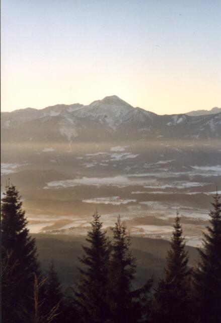
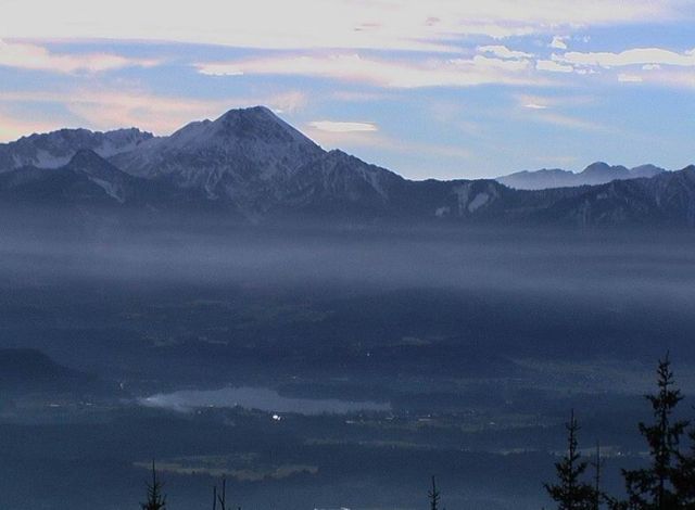
Different Inversions


.jpg)
.jpg)
.jpg)
|
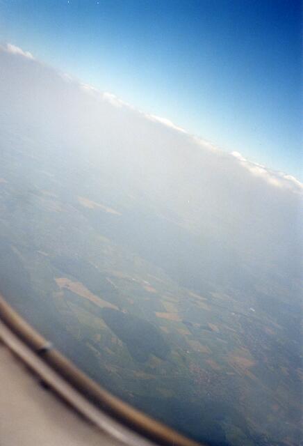
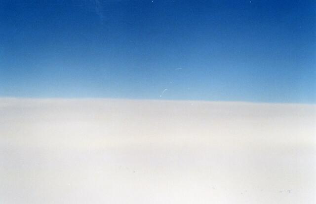
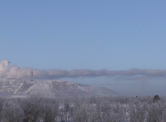
Inv1.jpg and Inv2.jpg show an inversion in the medium level without cloud formation at the inversion. In the upper level Cirrus clouds are recognizable. The poor quality of the images is due to an unclear window glass and the digitalization of the paper copy. In Inv3.jpg and Inv4.jpg inversions in the medium level above southern Sweden are shown. Thereby here clouds have formed at the inversions. Partly they are still in the Altocumulus humilis stage, mostly however already compressed to an Altocumulus layer. Inv5.jpg presents an inversion in the upper level without any
structure above the Baltic Sea which is below the cruising altitude
of approximately 10 km. It is not likely that it is at the tropopause
level since in these latitudes during summer it would be above
the cruising altitude. Though this layer seems to be optically
thick at the photograph, like a Cirrus layer, it was not an ordinary
cloud but a hazy fume. |
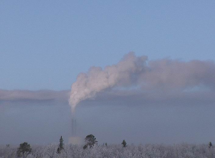
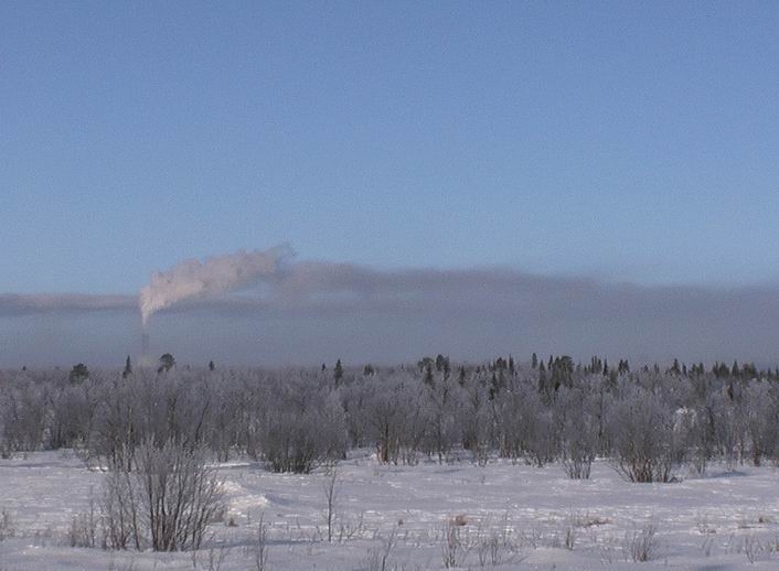
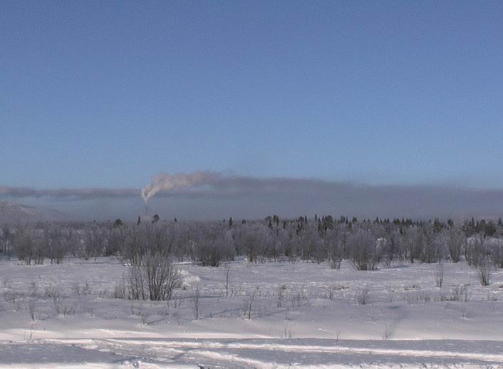
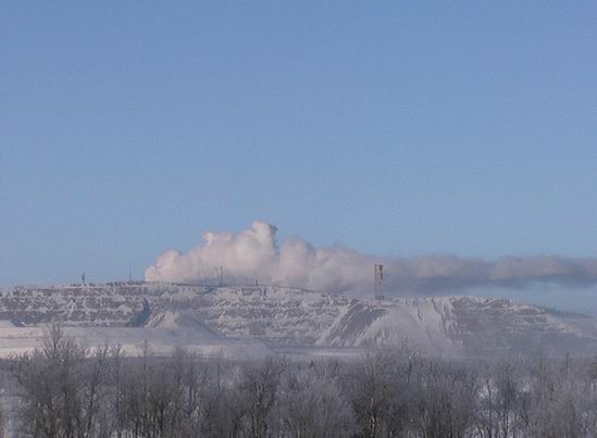
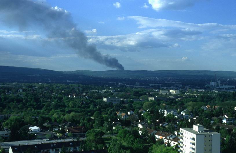
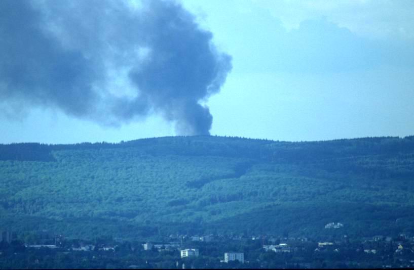
The exhaust plumes of the waste incinerator, the power plant (Inv9.jpg to Inv13.jpg) and the mine power plant (Inv14.jpg and Inv15.jpg) ascend within the stable ground layer. Thereby they expand until they are cooled down to the potential temperature of the environment and spread remaining at this altitude. Thereby the horizontal extension of the smoke plume can reach 10 km and more. This can be also noticed in the images Inv12.jpg and Inv13.jpg which were taken in the city of Kiruna. In Inv14.jpg the initial overshooting over the theta-level and the following falling back of the emitted air parcels can be recognized. TaunusFire1+2.jpg display the ascent of a smoke plume in the
Taunus that is not limited to the top by an inversion. But it
can expand undisturbed within the prevalent layering in the boundary
layer. |
The night before the sky was covered with clouds, so that the ground inversion did not derive from radiative cooling of the ground as in the images from Kiruna. In Darwin it rained quite a long period of time in the morning and the temperature was below 33°C which was the typical morning temperature. Here evaporation of raindrops and water at the ground led to a cooling of the lowest air layer, so that the ground inversion was caused by "evaporative cooling".
Inv1-5.jpg: S. Borrmann, flight from Stockholm to Frankfurt,
22 June 2002 1:00 to 3:00 p.m. |
![]()