|
|
|
Precipitation |
|
| Objects in Clouds | |
| Falling Rain Droplet | |
| Virga and Praecipitatio | |
| Microburst | |
| Rainshaft | |
| Falling Cloud | |
| Tropical Rain | |
| Tropical Rainforest | |
| Flood | |
| Diamond Dust | |
| Overview | |

Microburst and Rotor Cloud


|
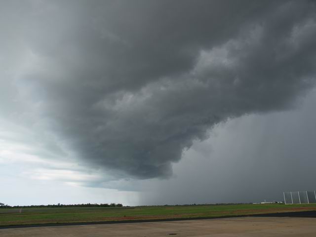
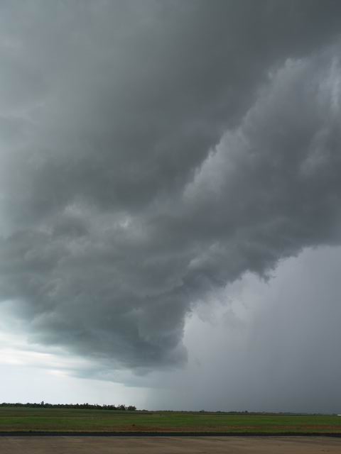
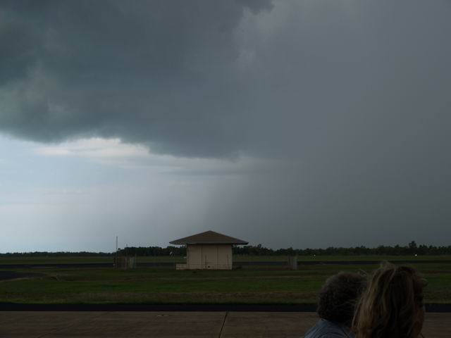
Phenomenology: Micro-bursts are transient (1 to 5 min), strong, locally confined (around 4 km in diameter) downwards winds, which seem to fall from clouds. The winds of a micro-burst can be recognized by falling rain curtains which horizontally spread at the ground and possibly rise up again in form of eddies. The process is schematically described in Scheme.jpg. Micro-burst winds are generated when falling precipitating air masses are heavily cooled down by evaporating hydrometeors, then touch the ground and are thereby forced to move horizontally. The winds of the micro-burst can reach top speeds up to 200 km/h, so that they are enormously dangerous for air traffic. Aircrafts which are approaching an airport for landing below thunderclouds can even be pressed down to the ground by micro-bursts. |
Microburst1.jpg to Microburst3.jpg might show a micro-burst, hence
in Microburst1.jpg the rain curtain near the ground seems to spread
horizontally in parallel to its bottom line. However, because of
the large distance this cannot be determined for sure. The situation
is more distinct in the series of five images at the bottom. |
Microburst1.jpg to Microburst3.jpg: S. Borrmann, flight Varig RG2375
from Fortaleza to Sao Paulo Brazil, 2 March 2004 at 4:50 p.m.
Olympus E-1 SLR with a 14-54 mm objective. Exposure and sensitivity choice (ASA 100) were performed by the camera. The colour range was set to sRGB with a resolution of 2560 x 1920 Pixel x 24 colours. |
![]()