
Cumulus mediocris/congestus pileus


.jpg)
.jpg)
.jpg)
.jpg)
.jpg)
.jpg)
.jpg)
.jpg)
.jpg)
.jpg)
.jpg)
.jpg)
.jpg)
.jpg)
.jpg)
.jpg)
.jpg)
.jpg)
.jpg)
.jpg)
.jpg)
.jpg)
.jpg)
.jpg)
.jpg)
.jpg)
.jpg)
.jpg)
.jpg)
.jpg)
.jpg)
.jpg)
.jpg)
.jpg)
.jpg)
.jpg)
.jpg)
.jpg)
.jpg)
.jpg)
.jpg)
.jpg)
.jpg)
.jpg)
.jpg)
.jpg)
.jpg)
.jpg)
.jpg)
.jpg)
.jpg)
.jpg)
.jpg)
.jpg)
.jpg)
.jpg)
.jpg)
.jpg)
.jpg)
.jpg)
.jpg)
.jpg)
|
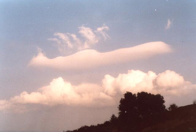
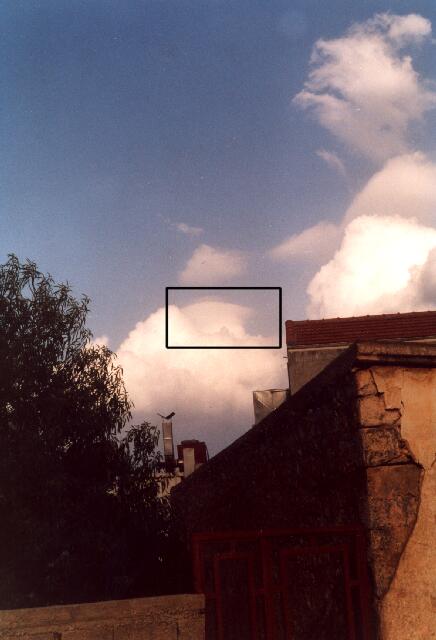
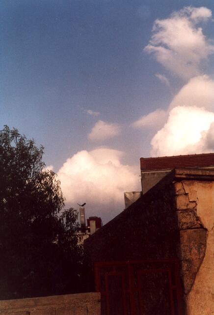
Cu_before.jpg, CuPileus1+2.jpg: The image Cu_before.jpg was taken around 7 p.m. at Crete near Finokalia. A cloud which resembles a leewave cloud occurs above the Cumulus mediocris in a short vertical distance. This veil-like cloud indicates that the air above the Cumulus mediocris is humid, i.e. near saturation so that cloud formation can easily occur. Later the Cumulus mediocris formed a cap which is called pileus. The affected area is marked in CuPileus1.jpg. CuPileus2.jpg is the same picture without the marking. A pileus cap is formed when humid air is lifted about a short vertical distance in a stable layered environment and condensation occurs. This lifting can for example be caused by ascending Cumulus cloud parts, which push the humid, but clear air above them by convection upwards. If the buoyancy of the Cumulus clouds below is large enough, the pileus can be completely penetrated. Mostly the remaining pileus cover drops once again hence it was formed in a stable atmospheric layering or the pileus is sucked into the Cumulus cloud. In both cases the pileus becomes invisible again. Also in the case of this cloud above Crete the pileus could be only noticed for few minutes. This means that a pileus can typically be only seen when one observes a convective cloud for a while. |
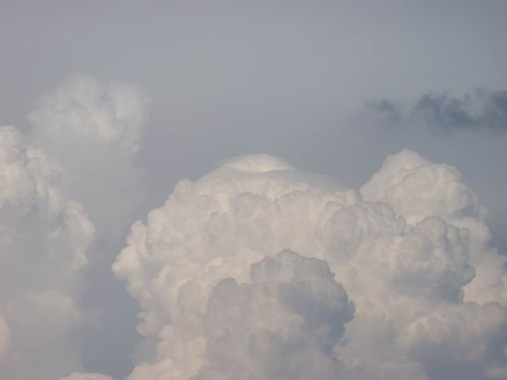
Cu_pileus3.jpg: On this day several thunderstorm cells were formed between Hunsrueck and Mainz. The Cumulus congestus cloud shown here grew between 4.30 p.m. and 6 p.m. to a Cumulonimbus with strong precipitation, but without generating a thunderstorm. An anvil of another Cb cloud above the Taunus which extended over the ascending Cu congestus inhibited this development. Pileus0-61.jpg: Here many, partly very similar images are presented,
showing that the pileus comes up within a few minutes and also disappears
again very quickly. The individual groups of pictures are related
to a single cloud or different parts of a larger Cu congestus cloud
cluster. Although the thumbnails look very similar, the full images
give many details. In some of the other chapters of the Cloud Gallery images of the pileus can be found (for example in chapter Wind shearing). |
Cu_before.jpg, CuPileus1+2.jpg: S. Borrmann; North-eastern Crete,
MINOS Field Campaign, 3 August 2001 |
![]()